.png)
1. Communal spaces
These are traditional spaces that were consciously built for religious congregations, socialising and recreation, but over time, they have been organically engulfed by urbanisation leading to a loss of character.

Urban Village squares
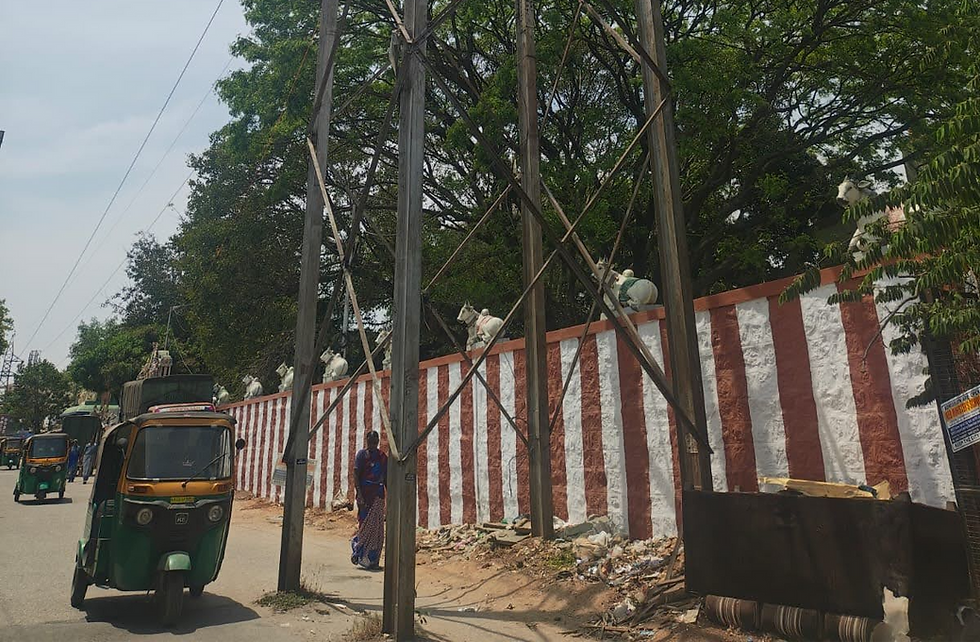
A square within an identified 'Urban Village' is typically a central open space that currently serves or used to serve as a hub for religious, cultural and economic activities, blending everyday life. They are often situated near significant landmarks like temples or marketplaces. Urban Village squares foster community interaction but can often be seen engulfed/overtaken by development.
Example of locations:
1. Guttigere, Meenakshi mall
2. Somweshwara temple square
3. Bull Temple square
4. Bisilu Mariamma temple square
5. Doddanakundi

Kattes
A katte is an elevated platform traditionally built around sacred trees like Banyan or Peepal. It often features small shrines and may serve a religious and social function, acting as a communal gathering spot for people to rest, meet, and more.
Example of locations:
1. Lazar Road
2. Bisilu Mariamma Temple Katte
3. Subbaiah Circle Katte
4. Kempegowda Circle Katte
2. Leftover spaces
Spaces that are left defunct or under-utilised after the implementation of planned infrastructure as they become unplanned edges and buffers which have a tendency to turn into negative spaces.
Infrastructure Buffers
Empty buffer spaces under or abutting infrastructure such as high-tension lines and large water pipelines. High-tension lines are mounted on transmission towers, making the area below it inaccessible and unattended.
A pipeline corridor is a large above ground pipe which is used for carrying water over a long distance with leftover space on either side.
Example of locations:
1. Pipeline road
2. Kasa rasa 2, Dry waste collection centre
3. Next to Hennur flyover
4. Byrasandra Lake

Green and blue edges
These are the spaces that border green (parks) and blue (lakes, rajakaluves) infrastructure. They might be pockets of under-developed spaces near the entrance gates or footpaths/streets running alongside them.
Example of locations:
1. Richards Park
2. Ulsoor Lake
3. Cubbon Park
4. K100
5. Yediyur Lake

Under flyovers / metro lines
These are typically un-utilised spaces under with flyovers, metro lines and in between clovers with enough head clearance for activities. They are often disconnected from pedestrian paths and usually overlooked as "leftover" land in busy intersections.
Example of locations:
1. Old Madras road
2. Beningnahalli Flyover
3. Domlur Flyover
4. Koramangala Flyover
5. Wheeler Rd Flyover
3. Multi-functional streets
These are streets that support one or more special public activities apart from the typical movement of people and vehicles, requiring a more specialised design.

Conservancy Lanes
These narrow public lanes (3-5m width) are back alleys of houses, historically used for manual scavenging but currently lie defunct. They may often be gated.
Example of locations:
1. Malleswaram conservancy Lanes
2. Richards town conservancy lane
3. Frazer town conservancy lanes

School access zones
A school access zone is the main street and nearest junctions within a 100m radius of all entrance gates of a school. This zone is deemed critically important for ensuring pedestrian safety, especially for children. They often experience high traffic speeds and congestion since many schools are located on major roads.
Example of locations:
1.Bishop Cottons
2. St Josephs (Kanteerva Stadium)

Walkers streets
These streets are frequently used for walking, exercise and play by local residents.
Example of locations:
1. 6th main road, Malleswaram
2. Wheeler road, Cooke Town

Shopping / Market streets
Streets with dense commercial activity, primarily supporting the buying and selling of products through shops and vendors. There may be restaurants on these streets, but shopping must be the dominant activity.
Example of locations:
1. 8th Cross, Malleswaram
2. Brigade Road
3. Commercial Street
4. Thippasandra

Food streets
Streets that are predominantly occupied by restaurants and food stalls/vendors, which may be permanent or temporary. Some streets may become food streets at certain times of the day or certain periods of the year such as during festivals.
Example of locations:
1. Mosque Road
2. VV Puram
3. Jayanagar 4th Block
4. Transportation and Circulation spaces
These are spaces of high vehicular-pedestrian conflict that require targeted interventions to make them safer for pedestrians.

Pedestrian Underpass/Overpass
An underpass is a tunnel-like passage for traffic flow beneath railway lines or another road. An overpass is present above high-traffic roads allowing only pedestrian movement (includes skywalks and railway crossings). The challenge here can pertain to the passage area or the entry/exit of the underpass or overpass.
Example of locations:
1. Pottery road
2. Frazer town
3. Whitefield overpass

Junctions and Road Islands
Junctions are high traffic meeting points of roads where pedestrians are most vulnerable and road islands are left over large spaces along roads, after standardisation of carriageway. It also includes a mid-block crossing.
Example of locations:
1. Brigade road junction
2. Mayohall road island
3. St Johns junction

Transit node and connecting streets
Spaces where passengers wait to board or disembark from one or more modes of transport such as bus stops, metro and railway stations. This can include streets that provide direct access to the transport mode(s).
Example of locations:
1. Mayohall Bus stop
2. Vidhana Soudha Metro station
3. Bangalore east railway station
4. KR Market metro station
5. Madiwala bus stand
The program is conceived by BBMP, Sensing Local and Institute of Urban Designers (Karnataka) and is supported by the Sustainable Mobility Network. Our outreach partner is the Bengaluru Ward Samithi Balaga.
%20(1).png)
_edited.png)
.png)